News Detail
A high-tech measurement system to evaluate river restorations
June 23, 2015 |
The revitalization of Switzerland’s channelized rivers and streams is a task that will take several generations to complete: under the Water Protection Act (revised in 2011), around 4,000 kilometres of degraded watercourses are to be ecologically enhanced over the next 80 years. But what counts as a successful restoration project? According to an Eawag review, there has been very little systematic evaluation of restoration measures to date, and standard evaluation criteria are lacking.
Between 1979 and 2012, the average restoration rate was almost 10 kilometres per year, but outcome evaluations are only documented for a small number of projects. In cases where data was collected, the emphasis was frequently placed on the distribution of flagship species such as trout. None of the 848 projects implemented over this period included an evaluation of the effects of restoration on exchanges between groundwater and surface water. But these interactions are essential to the functioning of aquatic ecosystems, as they control not only the availability of nutrients and dissolved oxygen but also water temperature and quality.
Effective restoration promoted by in-stream structures
Hydrogeologist Anne-Marie Kurth believes that groundwater-surface water interactions should be included in outcome evaluations. In her doctoral dissertation (Eawag/Neuchâtel University), she demonstrated that these interactions can be enhanced by river restoration: “We found that, for example, gravel islands can have positive effects on exchanges between groundwater and surface water – the rate of surface water downwelling was increased.” More generally, she concludes, changes to river morphology will help to re-establish groundwater-surface water interactions.
To allow these interactions to be continuously monitored over long distances in restored watercourses, Kurth developed a new measurement system. This takes advantage of temperature differences between groundwater and surface water to determine the direction of flow (upwelling or downwelling). The new method is based on the distributed temperature sensing technology (DTS; see box). Existing DTS methods could only be used to investigate interactions under gaining conditions (i.e. groundwater upwelling) in small streams. With the new method, measurements can be made irrespective of the size of the watercourse and the hydrological conditions – i.e. also in cases where surface water infiltrates into the subsurface. Because the system is remote-controlled and can be driven by solar power, monitoring can also be carried out at remote sites.
Hydrogeological effects studied for the first time
The applicability of the new method in the field was demonstrated in a study carried out on the Chriesbach in Canton Zurich. This urban stream – heavily engineered in the last century – was restored over a length of 900 metres in 2013/2014. Kurth explains: “We investigated and compared groundwater-surface water interactions before and after restoration. This was the first time the hydrogeological effects of restoration had ever been analyzed in a case study.”
Distributed temperature sensing (DTS)
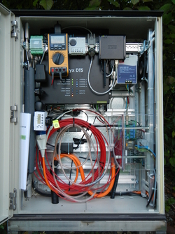
In the system used for this study, laser pulses are injected into a fibre-optic cable buried in the streambed. Light particles (photons) from the laser beam are backscattered, and their energy varies depending on the temperature of the fibre-optic cable. The change in energy, together with the time difference between pulse injection and backscattered light detection, makes it possible for the temperature to be determined accurately along the entire length of the cable (passive DTS). In the summer, when temperatures fall, cold groundwater will generally flow into surface water, and when temperatures rise, warm surface water will infiltrate into groundwater. In the winter, the situation is reversed. In the active DTS method, the metal cladding of the fibre-optic cable is heated and the reaction to this heating is analysed. Exchanges between groundwater and surface water can then also be determined for the section in question. A fibre-optic cable several hundred metres in length can thus be used for monitoring temperatures over long distances, with data being transferred automatically from the remote-controlled system.
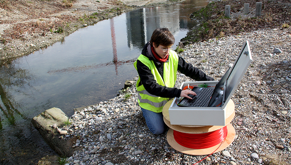
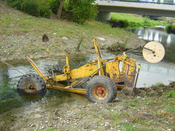
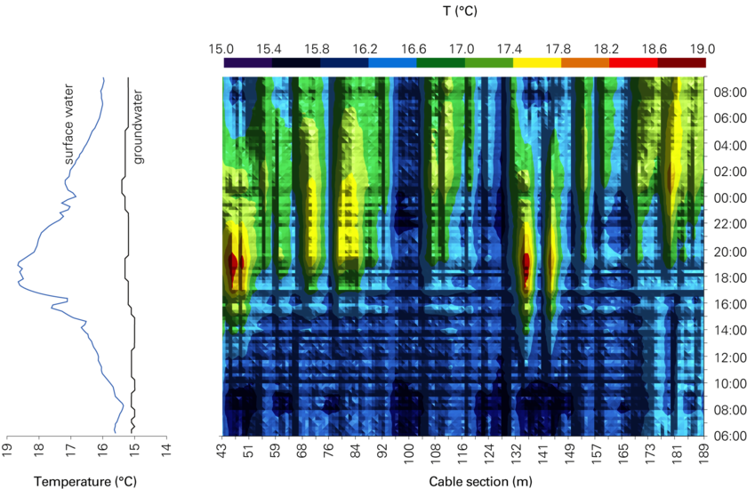
For the Chriesbach study, a fibre-optic cable was buried in the streambed at a depth of 40 centimetres with the aid of a specially designed tractor-pulled plough [Fig. 2]. After restoration work had been completed, active and passive DTS measurements were performed in summer 2014 [Fig. 1 and 3]. Although this experimental set-up, as Kurth concedes, is elaborate and relatively costly, there is no risk of equipment being lost during flood events, which means that long-term monitoring is possible.
Based on the findings of her study, Kurth recommends that outcome evaluations should be a requirement for all restoration projects, with comparable data being stored in a national database: “That’s the only way of ascertaining what measures under what conditions most effectively enhance interactions between groundwater and surface water – and ultimately how financial resources can best be employed in future restoration projects.”
Fig. 3: Temperatures measured in the Chriesbach (Canton Zurich) in summer 2014, from 06:00 to 09:00 on the following day. The curves on the left indicate surface water (light blue) and groundwater (black) temperatures. The colour plot on the right shows streambed temperatures measured along a roughly 150-metre section of buried fibre‑optic cable. It is apparent that in certain zones virtually no warm surface water flows past the cable into the groundwater (e.g. the section from 95 to 105 metres), while in others (e.g. at 47 and 137 metres) daily variation in surface water temperatures is clearly reflected in the streambed.
- Anne-Marie Kurth (2014): Investigation of Groundwater-Surface Water Interactions with Distributed Temperature Sensing (DTS). Ph.D. Thesis University of Neuchâtel. Centre for Hydrogeology and Geothermics.


