")
Abteilung Siedlungswasserwirtschaft
Siedlungswasserwirtschaft
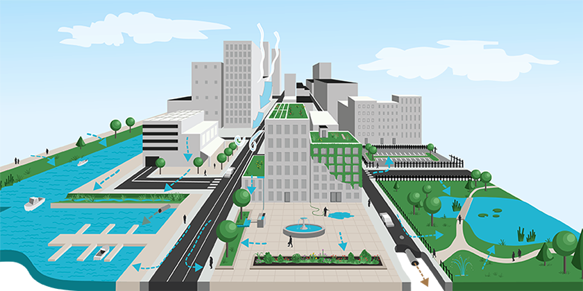
Unser Ziel ist es, die Entwicklung und das Management des städtischen Wassersystems mit Hilfe prozessorientierter Messtechniken, gezielter Experimente und innovativer Modellierungsmethoden zu optimieren. Mit einem Systemansatz bringen wir eine Reihe von Aspekten zusammen, die mit dem städtischen Entwässerungsnetz verflochten sind.
Urbanhydrologisches Feldlabor

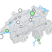
Das Feldlabor ist eine mittelfristig angelegte Initiative der ETH/Eawag, um ein wasserwirtschaftliches Messnetz in und um die Gemeinde Fehraltorf zu etablieren. Weiterlesen
Eawag-Empa Blue-Green Campus Lab

Das Eawag-Empa Blue-Green Campus Lab ist eine Initiative zur Erforschung von Klimaanpassungslösungen und zur Förderung der Zusammenarbeit zwischen Eawag und Empa. Weiterlesen
BlueX: Blue Nexus Lab - Reallabor für Wasser und Klimaanpassung

Urban Living Lab zur Vernetzung verschiedener Projekte im Bereich Wasser und Klimaanpassung. Weiterlesen
News
")
")

Publikationen
Cavadini, G. B., Manoli, G., & Cook, L. M. (2026). Cooling potential of stormwater blue-green infrastructure depends on soil type and water availability. Sustainable Cities and Society, 136, 107083 (15 pp.). doi:10.1016/j.scs.2025.107083, Institutional Repository
Cavadini, G. B. (2026). Stormwater management and heat mitigation performance of bluegreen infrastructure in a current and future climate (Doctoral dissertation). doi:10.3929/ethz-c-000797997, Institutional Repository
Dietzel, A., Moretti, M., Perrelet, K., & Cook, L. M. (2026). Urban heat exacerbates climatic risks to urban biodiversity. npj Urban Sustainability, 6, 4 (12 pp.). doi:10.1038/s42949-025-00309-6, Institutional Repository
Furrer, V., Mutzner, L., Froemelt, A., Junghans, M., Singer, H., & Ort, C. (2026). Mikroverunreinigungen in Mischwasserentlastung. Hochaufgelöste Zeitreihen zeigen starke Dynamik. Aqua & Gas, 106(3), 64-70. , Institutional Repository
Grant, R., Zanella, M. C., Gan, C., Pitton, M., Lachat, V., Ort, C., … Abbas, M. (2026). Wastewater-based surveillance of respiratory viruses in a geriatric hospital: a pilot study. Journal of Hospital Infection, 171, 1-10. doi:10.1016/j.jhin.2026.02.001, Institutional Repository
Joshi, P., Maurer, M., & Leitão, J. P. (2026). Identifying similar rainfall events across different periods to investigate temporal changes in hydrological performance of blue-green infrastructure. Journal of Hydrology, 666, 134827 (14 pp.). doi:10.1016/j.jhydrol.2025.134827, Institutional Repository
Nature’s Science in Shorts awards - Lucas Gobatti
"If we want to cool down our cities with vegetation, we need to start planting as soon as possible, because it takes time to get the full cooling benefits of urban greenery"
Paper "Using satellite imagery to investigate Blue-Green Infrastructure establishment time for urban cooling"