CORESIM: Integration von Fernerkundung, Beprobung und Modellen
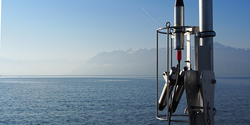
Binnengewässer sind umfassenden Umweltbelastungen ausgesetzt. In den letzten Jahrzehnten haben Wissenschaftler verschiedener Disziplinen die entsprechenden Auswirkungen mit unterschiedlichen Ansätzen und Informationsquellen untersucht. Deshalb integrieren wir in situ Messungen, Satellitendaten, und hydrodynamische und biologische Modellsimulationen, um Endnutzern zeitnah dreidimensionale Umweltinformationen von hoher Relevanz und Qualität zugänglich zu machen.
Die im Projekt CORESIM entwickelte Kopplung impliziert wechselseitige Mechanismen zwischen allen Informationsquellen. Modellsimulationen werden durch die Assimilation von in situ Messungen verbessert. Die Verarbeitung der Satellitendaten wird durch vertikal aufgelöste Feldmessungen und Simulationen der untersuchten Parameter verbessert. In situ Messungen erzielen schließlich eine bessere Aussagekraft, wenn entlang von Gradienten aus Satellitenbildern oder Modellsimulationen gemessen wird.
Das Beispiel einer solchen Kopplung liefert dreidimensionale Informationen und Prognosen für verschiedene Parameter im Genfersee: meteolakes.ch
array(3 items)0 => Snowflake\Publications\Domain\Model\Publicationprototypepersistent entity (uid=16719, pid=124)originalId => protected16719 (integer)
authors => protected'Bouffard, D.; Kiefer, I.; Wüest, A.; Wunderle, S.; Oder matt, D.' (89 chars)
title => protected'Are surface temperature and chlorophyll in a large deep lake related? An ana lysis based on satellite observations in synergy with hydrodynamic modelling and in-situ data' (169 chars)
journal => protected'Remote Sensing of Environment' (29 chars)
year => protected2018 (integer)
volume => protected209 (integer)
issue => protected'' (0 chars)
startpage => protected'510' (3 chars)
otherpage => protected'523' (3 chars)
categories => protected'lake surface temperature; MERIS; hydrodynamic model; limnology' (62 chars)
description => protected'Phytoplankton growth depends on various factors, and primarily on nutrient a vailability, light and water temperature, whose distributions are largely co ntrolled by hydrodynamics. Our main objective is to analyse the link between spatial and temporal variability of surface water temperature and algal con centration in a large lake by means of remote sensing and hydrodynamic model ling. We compare ten years of satellite images showing chlorophyll concentra tions and surface water temperature of Lake Geneva. Our observations suggest different correlations depending on the season. Elevated chlorophyll concen trations in spring are correlated with warmer zones. But, in summer, higher chlorophyll concentrations are observed in colder zones. We show with a thre e-dimensional hydrodynamic model that the spatial variability of the surface water temperature reflects the upwelling and downwelling zones resulting fr om wind forcing. In springtime, nearshore downwellings induce locally increa sed surface temperature and stratification, which are associated with high c hlorophyll concentration. In summertime, colder surface temperature area, of ten interpreted as transient upwellings, represents the thermal surface sign ature of wind-induced basin-scale internal waves, bringing either nutrients or phytoplankton from deeper layers to the surface. Our study suggests the l atter to be the dominant process, with the basin-scale internal wave activit y and associated transient summertime upwellings and downwellings having lit tle net effects on the algal concentration. This study finally demonstrates the necessity to connect remote sensing retrievals and three-dimensional hyd rodynamic modelling to properly understand the dynamic of the lake ecosystem s.' (1750 chars)
serialnumber => protected'0034-4257' (9 chars)
doi => protected'10.1016/j.rse.2018.02.056' (25 chars)
uid => protected16719 (integer)
_localizedUid => protected16719 (integer)modified_languageUid => protectedNULL
_versionedUid => protected16719 (integer)modifiedpid => protected124 (integer)1 => Snowflake\Publications\Domain\Model\Publicationprototypepersistent entity (uid=17789, pid=124)originalId => protected17789 (integer)
authors => protected'Nouchi, V.; Odermatt, D.; Wüest, A.; Bouffard, D.' (70 chars)
title => protected'Effects of non-uniform vertical constituent profiles on remote sensing refle ctance of oligo- to mesotrophic lakes' (113 chars)
journal => protected'European Journal of Remote Sensing' (34 chars)
year => protected2018 (integer)
volume => protected51 (integer)
issue => protected'1' (1 chars)
startpage => protected'808' (3 chars)
otherpage => protected'821' (3 chars)
categories => protected'inland waters; radiative transfer models; in field data acquisition; water q uality; non-uniformities; spectral reflectance' (122 chars)
description => protected'We investigate the impact on remote sensing reflectance by the vertical non- uniformities of water constituents. Reflectance simulated for 210 pairs of i n situ measured chlorophyll-a and turbidity profiles (z = 0–20 m) from Lak e Geneva are compared to simulations for uniform constituent gradients and n on-uniform profiles approximated by Gaussian curves, orthogonal layers and s teady gradients. Relevant concentration ranges are between 0 and 17 mg m<sup >−3</sup> for chlorophyll-a and 0 and 4.6 g m<sup>−3</sup> for total sus pended matter within the photic layer. Our results show that mesotrophic lak es are specifically sensitive to non-uniformities with 20% of the 210 sample s used in this study showing deviations of the spectral angle > 5° between a uniform assumption and observations which mostly occur for deeper-laying w ater constituents. By stressing the different use of blue and red parts of t he spectrum, we argue further that algorithms are affected by variable verti cal structures of algal and inorganic particles. Finally, we demonstrate tha t approximation models of the vertical structure of water constituents are a good solution to better account for non-uniformities in the development of invertible bio-optical models.' (1246 chars)
serialnumber => protected'' (0 chars)
doi => protected'10.1080/22797254.2018.1493360' (29 chars)
uid => protected17789 (integer)
_localizedUid => protected17789 (integer)modified_languageUid => protectedNULL
_versionedUid => protected17789 (integer)modifiedpid => protected124 (integer)2 => Snowflake\Publications\Domain\Model\Publicationprototypepersistent entity (uid=8141, pid=124)originalId => protected8141 (integer)
authors => protected'Kiefer, I.; Odermatt, D.; Anneville, O.; Wüest, A.; Bou ffard, D.' (90 chars)
title => protected'Application of remote sensing for the optimization of in-situ sampling for m onitoring of phytoplankton abundance in a large lake' (128 chars)
journal => protected'Science of the Total Environment' (32 chars)
year => protected2015 (integer)
volume => protected527 (integer)
issue => protected'' (0 chars)
startpage => protected'493' (3 chars)
otherpage => protected'506' (3 chars)
categories => protected'remote sensing; MERIS; chlorophyll-α; water quality monitoring; Lake Geneva ; phytoplankton; spatial heterogeneity' (114 chars)
description => protected'Directives and legislations worldwide aim at representatively and continuous ly monitoring the ecological status of surface waters. In many countries, ch lorophyll-<I>α</I> concentrations (CHL) are used as an indicator of phytopl ankton abundance and the trophic level of lakes or reservoirs. In-situ measu rements of water quality parameters, however, are time-consuming, costly and of unknown but naturally limited spatial representativeness. In addition, t he variety of the involved lab and field measurement methods and instruments complicates comparability and reproducibility.<BR/> Taking Lake Geneva as a n example, 1234 satellite images from the MERIS sensor on the Envisat satell ite from 2002 to 2012 are used to quantify the spatial and temporal variatio ns of CHL concentrations. Based on histograms of spring, summer and autumn C HL estimates, the spatial representativeness of two existing in-situ measure ment locations is analysed. Appropriate sampling frequencies to capture CHL peaks are examined by means of statistical resampling. The approaches propos ed allow determining optimal in-situ sampling locations and frequencies. The ir generic nature allows for adaptation to other lakes, especially to establ ish new survey programmes where no previous records are available.' (1282 chars)
serialnumber => protected'0048-9697' (9 chars)
doi => protected'10.1016/j.scitotenv.2015.05.011' (31 chars)
uid => protected8141 (integer)
_localizedUid => protected8141 (integer)modified_languageUid => protectedNULL
_versionedUid => protected8141 (integer)modifiedpid => protected124 (integer)
Are surface temperature and chlorophyll in a large deep lake related? An analysis based on satellite observations in synergy with hydrodynamic modelling and in-situ data
Phytoplankton growth depends on various factors, and primarily on nutrient availability, light and water temperature, whose distributions are largely controlled by hydrodynamics. Our main objective is to analyse the link between spatial and temporal variability of surface water temperature and algal concentration in a large lake by means of remote sensing and hydrodynamic modelling. We compare ten years of satellite images showing chlorophyll concentrations and surface water temperature of Lake Geneva. Our observations suggest different correlations depending on the season. Elevated chlorophyll concentrations in spring are correlated with warmer zones. But, in summer, higher chlorophyll concentrations are observed in colder zones. We show with a three-dimensional hydrodynamic model that the spatial variability of the surface water temperature reflects the upwelling and downwelling zones resulting from wind forcing. In springtime, nearshore downwellings induce locally increased surface temperature and stratification, which are associated with high chlorophyll concentration. In summertime, colder surface temperature area, often interpreted as transient upwellings, represents the thermal surface signature of wind-induced basin-scale internal waves, bringing either nutrients or phytoplankton from deeper layers to the surface. Our study suggests the latter to be the dominant process, with the basin-scale internal wave activity and associated transient summertime upwellings and downwellings having little net effects on the algal concentration. This study finally demonstrates the necessity to connect remote sensing retrievals and three-dimensional hydrodynamic modelling to properly understand the dynamic of the lake ecosystems.
Bouffard, D.; Kiefer, I.; Wüest, A.; Wunderle, S.; Odermatt, D. (2018) Are surface temperature and chlorophyll in a large deep lake related? An analysis based on satellite observations in synergy with hydrodynamic modelling and in-situ data, Remote Sensing of Environment, 209, 510-523, doi:10.1016/j.rse.2018.02.056, Institutional Repository
Effects of non-uniform vertical constituent profiles on remote sensing reflectance of oligo- to mesotrophic lakes
We investigate the impact on remote sensing reflectance by the vertical non-uniformities of water constituents. Reflectance simulated for 210 pairs of in situ measured chlorophyll-a and turbidity profiles (z = 0–20 m) from Lake Geneva are compared to simulations for uniform constituent gradients and non-uniform profiles approximated by Gaussian curves, orthogonal layers and steady gradients. Relevant concentration ranges are between 0 and 17 mg m−3 for chlorophyll-a and 0 and 4.6 g m−3 for total suspended matter within the photic layer. Our results show that mesotrophic lakes are specifically sensitive to non-uniformities with 20% of the 210 samples used in this study showing deviations of the spectral angle > 5° between a uniform assumption and observations which mostly occur for deeper-laying water constituents. By stressing the different use of blue and red parts of the spectrum, we argue further that algorithms are affected by variable vertical structures of algal and inorganic particles. Finally, we demonstrate that approximation models of the vertical structure of water constituents are a good solution to better account for non-uniformities in the development of invertible bio-optical models.
Nouchi, V.; Odermatt, D.; Wüest, A.; Bouffard, D. (2018) Effects of non-uniform vertical constituent profiles on remote sensing reflectance of oligo- to mesotrophic lakes, European Journal of Remote Sensing, 51(1), 808-821, doi:10.1080/22797254.2018.1493360, Institutional Repository
Application of remote sensing for the optimization of in-situ sampling for monitoring of phytoplankton abundance in a large lake
Directives and legislations worldwide aim at representatively and continuously monitoring the ecological status of surface waters. In many countries, chlorophyll-α concentrations (CHL) are used as an indicator of phytoplankton abundance and the trophic level of lakes or reservoirs. In-situ measurements of water quality parameters, however, are time-consuming, costly and of unknown but naturally limited spatial representativeness. In addition, the variety of the involved lab and field measurement methods and instruments complicates comparability and reproducibility. Taking Lake Geneva as an example, 1234 satellite images from the MERIS sensor on the Envisat satellite from 2002 to 2012 are used to quantify the spatial and temporal variations of CHL concentrations. Based on histograms of spring, summer and autumn CHL estimates, the spatial representativeness of two existing in-situ measurement locations is analysed. Appropriate sampling frequencies to capture CHL peaks are examined by means of statistical resampling. The approaches proposed allow determining optimal in-situ sampling locations and frequencies. Their generic nature allows for adaptation to other lakes, especially to establish new survey programmes where no previous records are available.
Kiefer, I.; Odermatt, D.; Anneville, O.; Wüest, A.; Bouffard, D. (2015) Application of remote sensing for the optimization of in-situ sampling for monitoring of phytoplankton abundance in a large lake, Science of the Total Environment, 527, 493-506, doi:10.1016/j.scitotenv.2015.05.011, Institutional Repository