Department Water Resources and Drinking Water
Projects

Times Series of concluded Projects
Spot samples in river Glatt (1972 until 1977)
Description
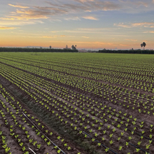
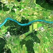
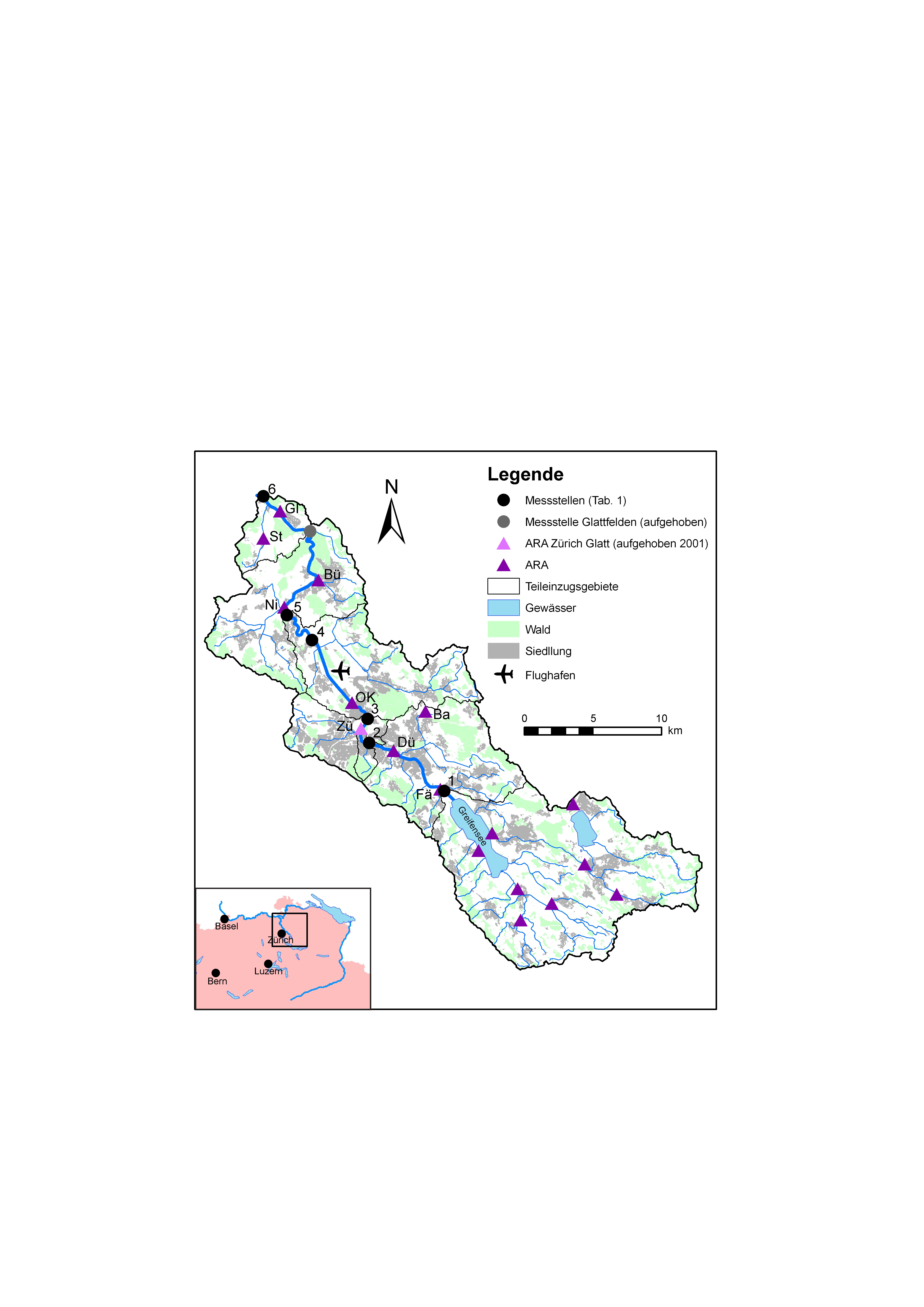
Along river Glatt and river Chriesbach, spot samples were taken in an approximately weekly rhythm at five different stations (excelsheet) from June 1972 until April 1977 (map).
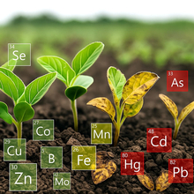
In those samples physical, geochemical, anthropogenic parameters and heavy metals were measured.(analytical methods)
Aim
This project served as a pilot project for new extensive chemical examinations of flowing waters with regard to:
- sample taking
- sample preservation
- chemical analysis
- data preparation
- data storage
- data analysis
- assessment of the water bodies
Apart from this, strongly polluted water from river Glatt was analyzed.
Data Files
- Glatt-Rheinsfelden.xlsx
- Glatt-Opfikon.xlsx
- Glatt-Niederglatt.xlsx
- Glatt-Glattfelden.xlsx
- Glatt-Faellanden.xlsx
- Glatt-Aubruecke_Hagenholz.xlsx
- Chriesbach-Duebendorf.xlsx
Structure of the Data Files
- measured data
- loads
- annual average of concentrations and loads
- graphs of time series of concentrations and loads
Data Control
comparing:
- calculated anions / calculated cations
- conductivity / total hardness
- calculated conductivity / measured conductivity
- total hardness / (sulfate + alkalinity)
- Na/K, Na/Cl
- nitrate / total nitrogen, (total nitrogen - nitrate) / suspended solids (where: total nitrogen = nitrite + nitrate + kjeldahl nitrogen)
- DRP / total phosphor, (total phosphor - DRP) / suspended solids
- DOC / TOC, (TOC – DOC) / suspended solids
- maxima and minima, annual averages of concentrations and ratios compared with those of former years
- temperatures and discharge proportions
- plausibility of extreme values. Incorrect values were eliminated.
Publication List
- Zobrist J. et al. (2011): 77 Jahre Untersuchungen an der Glatt. gwa 9, 315-327 (pdf) This publication contains furthermore all important constructions works which have been accomplished at river Glatt.
- Zobrist J. et al. (1976): Charakterisierung des chemischen Zustandes der Glatt. gwa 56, 97-114 (pdf)
Responsible Persons
Jürg Zobrist as project leader and Ursula Schoeneberger for data storage.
Data of different rivers from 1965 till 1973
Spot Samples of various Swiss Rivers from 1965 until 1973
Description
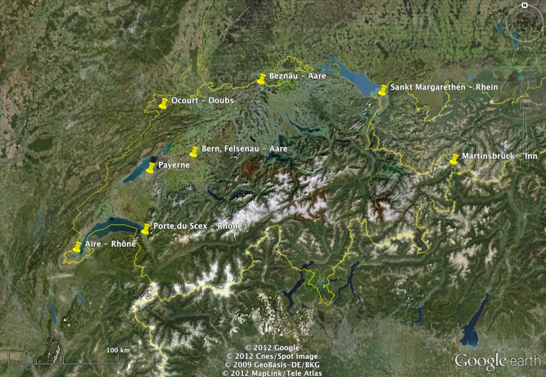
Spot samples were taken and analysed in a quarterly rhythm at eight different stations (excelsheet) and map distributed all over Switzerland from 1965 until 1973.
- Aare - Bern, Felsenau
- Aare - Beznau
- Broye - Payerne
- Doubs - Ocourt
- Inn - Martinsbruck
- Rhein - Sankt Margarethen
- Rhône - Aïre
- Rhône - Porte du Scex
Monitoring Program
In those samples, physical, geochemical and anthropogenic parameters were measured.(analytical methods)
Origin of Data
Data publication in the Hydrological Yearbook of Switzerland.
Data files
Aggregated Samples of Rhein - Schmitter 1972 /1973
Description
At the hydrological monitoring station Rhein - Schmitter aggregated samples were collected and analysed in an approximately weekly rhythm in 1972 and 1973.
Aim and Monitoring Program
Based on the program of International Commission for the Protection of the Rhine (IKSR) to analyse the input of nutrients from tributary waters into lake Bodensee, the hydrological monitoring station Rhein - Schmitter was equipped for continious water sampling, measuring and data recording. The samples were taken in a weekly rhythm and analysed at EAWAG on components of nitrogen and phosphor proportional to the discharge. At high water discharge (Q > 330 m3/sec) samples were collected in a lower cadence into a separate collector (samples may therefore overlap in collection time). Averages of water temperature, pH or conductivity originate from the continuous recording. The data were published in the Hydrological Yearbook of Switzerland.
Origin of Data
Data publication in the Hydrological Yearbook of Switzerland.